Fleet Management
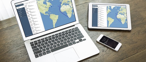
Work smarter, save time and achieve your goals with our advanced, global satellite tracking software, patent-pending blended tracking technology and interactive tools and layers.
For shipowners, ship managers, charterers and fleet managers that require fleet-wide situational awareness, the Pole Star platform offers the near real-time data, actionable intelligence and global visibility needed to increase operational efficiency, enable decision making and support compliance.
Benefits
By combining reliable position reporting and detailed maps with accurate zones, up-to-date weather layers, interactive tools and an intuitive mobile-responsive user interface, we can offer you a complete and near real-time picture of your fleet in relation to nearby and current threats, risks and regulatory requirements.
Ensuring the safety and security of your fleet (while managing risks, maximising efficiency and satisfying regulatory, environmental and conservation requirements) requires a near real-time picture of where your ships are in relation to security threats, risks and regulatory zones.
By combining reliable position reporting, up-to-date maps, zones and accurate weather forecasts as well as automatic and interactive tools, we can offer you a complete and near real-time picture of your fleet in relation to nearby and current threats, risks and regulatory requirements.
When you need to make decisions fast, you need more than data. You need insights and intelligence that enable you to take action. With on-demand polling, automatic zone alerts, near real-time cyclone data plus accurate weather forecasts, you get fleet-wide intelligence, allowing you to make informed decisions and take action to meet ETAs or avoid high-risk areas.
Assess risk. Become more proactive. Improve performance. These are all benefits of effective planning. The Pole Star platform offers interactive tools that allow you to assess immediate and long-term risks and threats to your fleet and plan your response or routes accordingly.
With the custom report engine, you can create, download, save and share tamperproof ship movement reports for use in arbitration or as evidence of compliance with:
- Conditions of insurance
- Sanctions regulations
- Environmental obligations
- Conservation measures
Features
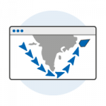
Our patent-pending blended tracking technology combines position data from multiple satellite tracking services (including Inmarsat-C, IsatData Pro and AIS) into a single, seamless position track to provide you with richer, more accurate information.

You can stay connected, even when you are not logged in. Create automated alerts on entry/exit from key zones (e.g. EEZs, high risk piracy areas, etc.) and get notifications delivered to you via email and SMS.
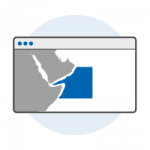
Display key industry zones (including ECAs, EEZs, high-risk areas, environmental and regulatory zones) on the map or create your own custom zones (rectangle, circular or polygon) for a near real-time picture of your fleet in relation to nearby and current threats, regional risks and regulatory requirements.
With weather layers, you can display forecast meteorological conditions (up to 7 day forecast) on the interactive map, or review your planned route against forecast weather conditions. Includes a wide range of weather and environmental layers. Our high quality weather data is updated every 6 hours and provided by Tidetech.
Review a ship’s historical movements for analysis in a single click. Click on a ship to see its historic position track on the map (30 days of trail history).
Advanced reporting engine with queries and filters allows you to download historical data in CSV format for analysis, sharing with colleagues or evidentiary purposes.

Big, interactive maps with features including: zoom, pan, weather, zones and distance measurement tool. Your choice of four map types including C-MAP charts, street map, hybrid map and satellite map.
Comments or questions to webmaster@panama-psa.com / Privacy policy Copyright © 2004 PSC Holdings, S.A. All rights reserved.
